Frequestly Asked QuestionsClick headers below to expand
What is the San Francisco Bay Joint Venture?
Restoring Cullinan Ranch. Photo by Caroline Warner.
The San Francisco Bay Joint Venture (SFBJV) is one of 18 national habitat Joint Ventures. For 25 years Joint Ventures have been working to protect and restore wildlife habitat. They bring together people who share the vision of a North American landscape thriving with healthy populations of birds.
Here in the Bay Area that means protecting wetland habitats of all kinds – bay habitats, rivers and streams (a.k.a. riparian corridors), seasonal ponds, and coastal shoreline – for the benefit of waterfowl, fish and other wildlife, including people!
More information on the SFBJV »
What is a wetland?
A wetland is a broad term referring to land that is wet, with specific types of soil, plants and occasionally wildlife that are only found in these special places.
Examples of many types of Bay Area wetlands can be found along Highway 37 (the flyway Highway) connecting Vallejo to Novato in the North Bay, such as:
- Open water, like the shallow lagoons you see on either side of Highway 37 between Vallejo and the Sears Point turn off (Highway 116);
- Shallow or intermittently flooded land, such as the tidal marshes you see looking south toward the bay,
- Vegetated areas with grasses that are only sometimes or occasionally wet, such as those near the Lakeville Rd intersection.
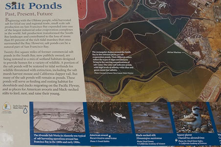
If you want to learn more about different types of wetland habitats, especially those found in the San Francisco Bay area, please visit the South Bay Salt Pond Restoration Project website.
Why do we need wetland habitats?
Wetlands serve us in so many ways!! They provide vital wildlife habitat, protect shorelines, cleanse pollutants, buffer the impacts of floodwaters and offer lots of public recreation opportunities.
Greko Island
Why should I care about wetlands in the bay area?
An estimated 90% of the tidal wetlands that historically rimmed the Bay until the mid 1800s have either been destroyed or damaged! Right now though, the situation is changing because of people who care!! From small creek groups working to clean and protect neighborhood streams, to citizen scientists helping to monitor bird responses, or members of large stakeholder groups helping to plan one of the largest restorations in the country, people are making a difference!
In all of California, much of the remaining wetland habitats are found right here! In fact, San Francisco Bay is one of only six estuaries considered to be of hemispheric importance to shorebirds according to the Western Hemispheric Shorebird Reserve Network and has just been designated as a RAMSAR Site of International Importance.
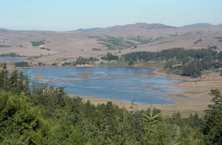
Sonoma Baylands
What does it mean to restore a wetland?
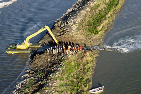
Breaching a levee, South Bay. Photo by Marc Bittner
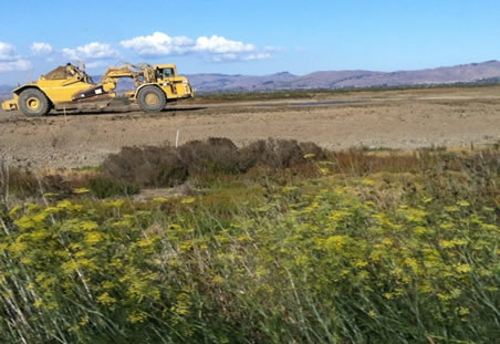
Restoration has and can still mean re-establishing the natural state or original condition of an area that has been altered. But more and more so, it is really about restoring environmental functions to an area in order to provide a variety of current and anticipated needs. When it comes to actual wetland restoration projects in the Bay Area, this can involve many different things.
Restoration projects often involve a variety of considerations and components, including the creation of habitat for a variety of wildlife, planting seedlings or removing non-native plants and planting native ones, or removing obstacles that prevent a river from following its natural course
Where can I see wetlands and wildlife around the bay?
In the North
Sonoma Baylands. Photo by Stephen Joseph
Take our tour – whether you are driving east or west along Highway 37, this audio/visual tour provides information about the 40,000 acres of wetlands currently under protection thanks to a variety of Joint Venture partners.
While driving along Highway 37, where can I see wetlands?
Heading east on Highway 37 from Novato:
Sonoma Baylands: Public access to the Sonoma Baylands Bay Trail starts at the Port Sonoma Marina, west and south of the intersection of Highway 37 & Lakeville Highway.
San Pablo Bay National wildlife refuge area: there is a public viewing point south of Highway 37, just east of the Sears Point Raceway (Highway 121) turnoff. Also, the Sonoma Creek Bridge has public access and parking either side of the bridge, on 37, about 1-2 miles east of the 121 intersection.
Heading West on Highway 37 from Vallejo
San Pablo Bay National Wildlife Refuge area: see above, Sonoma Creek.
Where are the hiking trails along Highway 37?
Giacomini Wetland Restoration Project
Heading east on Highway 37 from Novato:
Sonoma Baylands: A 3.5 mile North Bay extension of the Bay trail is being prepared/installed and will be ready for public access by April 2006. There are bathrooms at Port Sonoma for trail users. (for directions see above under viewing spots)
San Pablo Bay National wildlife refuge: There are approximately 8 miles of hiking trails at the pull off south of Highway 37, just east of the Sears Point Raceway (Highway 121) turnoff.
Heading West on Highway 37 from Vallejo:
See above regarding the Sonoma Creek pull off, which offers fishing.
Other wetland sites in the North Bay include:
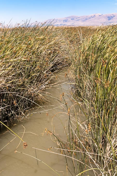
South Bay marsh grass
- The Laguna de Santa Rosa
- Triangle Marsh in Corte Madera, across from Ring Mountain
- Hamilton/Bel Marin Keys
- China Camp State Park in San Rafael
In the East Bay
The East Bay is filled with birding opportunities, recreational sites, urban creeks, and more. Many locations are accessible by public transit and the East Bay Regional Park system, along with the Urban Creeks Council are great resources for locating areas you can visit and enjoy!
Along the coast
Our coastal waters offer endless opportunities to spend the day in or near a wetland, including quite a few wetland restoration projects in progress.
- Point Reyes National Seashore and Giacomini Wetlands restoration project
- Muir Beach - take a tour and learn more
In San Francisco
Between the California State Parks Foundation and Golden Gate National Recreation Area you will find a lot of newly restored wetland areas to visit within the San Francisco city limits.
- Tennessee Hollow in the Presidio
- Crissy Field
- Candlestick Point State recreation area -Yosemite slough
In the South Bay
With the largest wetland restoration on the West Coast of North America in progress, it is hard not to be near a wetland restoration project in the South Bay
- Don Edwards National Wildlife Refuge
- Don Edwards San Francisco Bay National Wildlife Refuge in Newark
- Don Edwards San Francisco Bay National Wildlife Refuge in Alviso
- South Bay Salt Pond Project
South Bay Salt Ponds
Around the bay
If you want to do it all by foot – you can be in or near LOTS of wetland habitats when you follow along any part of The Bay Trail. With over 60% of its goal achieved as of 2012, the trail is a planned recreational corridor that, when complete, will encircle San Francisco and San Pablo Bays with a continuous 500-mile network of bicycling and hiking trails. It will connect the shoreline of all nine Bay Area counties, link 47 cities, and cross the major toll bridges in the region.